A powerful late-season snowstorm is moving toward Colorado this week, bringing the potential for heavy snowfall, colder temperatures, and difficult travel conditions across the state. Meteorologists warn that this system could impact both mountain regions and lower elevations, despite the calendar moving deeper into spring.
The developing Winter Storm Watch highlights how volatile weather patterns remain across the United States, with winter-like conditions still affecting several regions.
Met Gala 2026: Theme, Ticket Prices And How To Watch Fashion’s Biggest Night
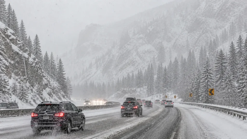
Winter Storm Watch Signals Major Midweek Snowfall
The storm is expected to intensify as it moves east into the Colorado Rockies, with the most significant impacts forecast from Monday night through Wednesday. Higher elevations, particularly in the Front Range mountains and foothills, could see more than a foot of snow, with some areas potentially receiving even higher totals .
This system originates from a broader weather pattern that has already produced heavy snowfall in western regions. In some areas, snowfall totals could reach several feet, especially in elevated terrain where conditions are most favorable for accumulation .
Meteorologists say the combination of cold air and incoming moisture will create ideal conditions for widespread snowfall, particularly during peak storm activity late Tuesday into early Wednesday.
New MSC Cruises Theme Park Unveiled With Thrilling Ocean Rides And Family Attractions
Snow And Rain Expected Across Denver And Plains
While mountain regions are expected to experience the heaviest snow, lower elevations including the Denver metro area are also likely to see a mix of rain and snow. Early in the week, conditions will remain relatively mild, but a cold front moving in by Monday evening will trigger a sharp shift in weather patterns.
Several inches of snow could accumulate along the I-25 corridor and nearby plains, especially as temperatures drop overnight. Forecasters note that snowfall totals in these areas will depend on how quickly temperatures fall and how intense precipitation becomes.
There is also concern about wet, heavy snow accumulating on trees that have already begun spring growth. This could lead to localized issues such as falling branches or minor power disruptions.
Delta Flight 1323 Delayed After Passenger Refuses To End Phone Call Before Takeoff
Travel And Safety Concerns As Storm Peaks
Travel conditions are expected to deteriorate rapidly in mountainous regions, where snowfall rates could become intense during the peak of the storm. Roads may become hazardous, particularly late Tuesday into Wednesday morning when accumulation is expected to be at its highest.
Officials are advising drivers to prepare for delays, reduced visibility, and potentially dangerous road conditions. Travelers heading into higher elevations are urged to monitor forecasts closely and plan accordingly.
Beyond Colorado, the broader weather system is also bringing unseasonably cold conditions to parts of the Midwest and Northeast, showing the widespread impact of this late-season pattern.
Conditions are expected to improve later in the week as the storm system moves east and temperatures begin to rebound. By the second half of the week, a return to more typical spring weather is anticipated, offering relief after several days of winter-like conditions .
Edmond Oklahoma Shooting Leaves At Least 10 Injured At Lake Arcadia Party

Diana Luci is a U.S.-based Latest and financial news writer covering Social Security, IRS tax updates, SNAP benefits, Medicare, and government assistance programs. She focuses on simplifying complex financial and policy topics into clear, easy-to-understand information for everyday readers.